A marine forecast is not a promise that every mile of water will behave the same way. The National Weather Service publishes conditions across broad zones, and the actual wind or waves at your boat can land above or below the forecast range. Reading the forecast well means understanding both what the numbers say and how much uncertainty your trip can tolerate.
Forecast ranges are not guarantees
The NWS marine forecast guide tells boaters to obtain the latest forecast before departure and pay attention to Small Craft Advisories, Gale Warnings and Storm Warnings. A forecast range describes expected conditions over an area and period of time; it does not guarantee that every location will stay at the calm end of that range.
That is why margin matters. If a trip only works when the wind stays at the lowest forecast value and the water remains smoother than expected, the plan has very little room for error. A more conservative plan accounts for the possibility that actual conditions arrive near the rougher end of the forecast.
For a small boat, kayak or exposed crossing, that difference can be significant even when the forecast does not look dramatic on a phone screen.
Learn the warning vocabulary
Routine forecasts and urgent warnings serve different purposes. A Special Marine Warning is more immediate than a normal forecast update. NWS says one may be issued for sudden winds over 35 knots, waterspouts and qualifying hail.
The practical lesson is that a morning forecast is not the final word once you are underway. Conditions can develop quickly enough that the information you need later in the day is a warning, not the forecast you read at breakfast.
Small Craft Advisories, Gale Warnings and Storm Warnings are also signals that deserve attention before departure. The exact meaning and local thresholds matter less than the decision habit: do not treat a posted advisory or warning as background text. Read what the office is telling mariners in the zone you plan to use.
Wind direction can matter as much as wind speed
A single wind number does not describe the entire ride. Wind direction, wave period, current, inlets and local terrain can change how the same forecast feels on the water.
A wind that runs with a protected shoreline may feel very different from the same speed blowing across a long stretch of open water. Conditions at an inlet can also differ from conditions well inside a bay. A forecast zone is a starting point, not a substitute for understanding the route.
That is why trip planning should look at the path, not just the destination. Ask which parts of the route are exposed, where an early turn-around is possible and where the boat would have to commit to a crossing before reaching the next protected area.
Wave height is only part of the ride
Boaters often focus on forecast wave height because it is easy to visualize, but wave period and direction can affect how comfortable or difficult those waves feel. Short, closely spaced waves can create a rough ride even when the listed height does not sound intimidating.
Local current can complicate that picture further. Where current opposes wind or waves, the water may become steeper or less comfortable than a simple height number suggests. The marine forecast should be read alongside knowledge of the local route rather than reduced to one acceptable or unacceptable number.
Keep weather information available underway
NWS recommends marine VHF capability with NOAA Weather Radio channels so warnings can still reach you after leaving the dock. A phone can be useful, but coverage may fade precisely where the trip becomes more remote.
Before departure, know how you will receive changing weather information once you are on the water. If your only plan is to refresh a phone app, think about what happens when the signal disappears.
Monitoring also matters because a good departure forecast does not freeze conditions in place. If clouds build, the wind changes, visibility drops or new warnings are issued, the safest decision may be to shorten the trip rather than wait for the original forecast to become true again.
Check the trend, not just the snapshot
A forecast is easier to use when you know whether conditions are improving or deteriorating. Look at the hours before and after the planned trip. If winds are forecast to build through the afternoon, an early departure does not remove the need for a realistic return time.
The same idea applies to fronts and thunderstorms. The goal is not to become a meteorologist; it is to understand whether your weather window is widening or closing while you are out.
Give yourself an exit plan
Before leaving the dock, identify the conditions that would make you turn around. That decision is easier to make on land than after fuel, time and expectations have been invested in the trip.
Know the sheltered routes, alternate ramps or safe places to wait if they exist. If the only way home requires crossing the most exposed water on the route, the return leg deserves at least as much attention as the outbound forecast.
NWS safe-boating guidance for during the trip emphasizes monitoring weather while underway and responding to changing conditions rather than assuming the original plan must be completed.
A practical pre-departure routine
Check the marine forecast the day before to understand the trend. Check it again immediately before leaving. Read active advisories and warnings, not just the wind and wave boxes. Compare the forecast with the most exposed part of your route, and decide what conditions would trigger a turn-around.
Then keep monitoring once you are underway.
The useful question is not simply, “What does the forecast say?” It is, “What will I do if the water is worse than the forecast, and how quickly can I get somewhere safer?” That is the difference between reading a forecast and actually using one.
RECOMMENDATIONS
All About The Life designs from Texas Thread Theory, inspired by the places you go and the stories you bring back.
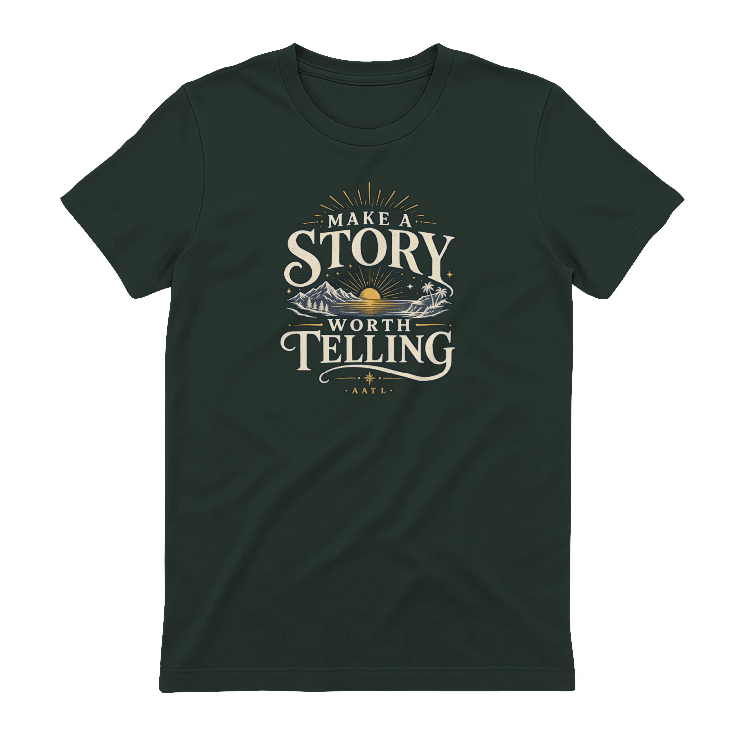
Make A Story Worth Telling
A scenic vintage-inspired design that encourages you to “Make A Story Worth Telling.” Mountains, water, sunset, and tropical details give it an adventurous feel that’s perfect for travelers, explorers, and anyone who wants a life filled with moments worth remembering.